
Johnston voters may decide on a $40 million flood bond to fund stormwater management and sewer upgrades in the wake of four major flood events over the past year.
On Feb. 12, Johnston Town …
This item is available in full to subscribers.
We have recently launched a new and improved website. To continue reading, you will need to either log into your subscriber account, or purchase a new subscription.
If you are a current print subscriber, you can set up a free website account by clicking here.
Otherwise, click here to view your options for subscribing.
Please log in to continue |
|


Johnston voters may decide on a $40 million flood bond to fund stormwater management and sewer upgrades in the wake of four major flood events over the past year.
On Feb. 12, Johnston Town Council passed a resolution asking the “Rhode Island General Assembly to enact legislation authorizing the town to issue, not to exceed $40,000,000 General Obligation Bonds, Notes and other evidences of indebtedness to finance construction, addition, renovation, improvement, alteration, repair, furnishing and equipping of stormwater management and sewer facilities throughout the Town.”
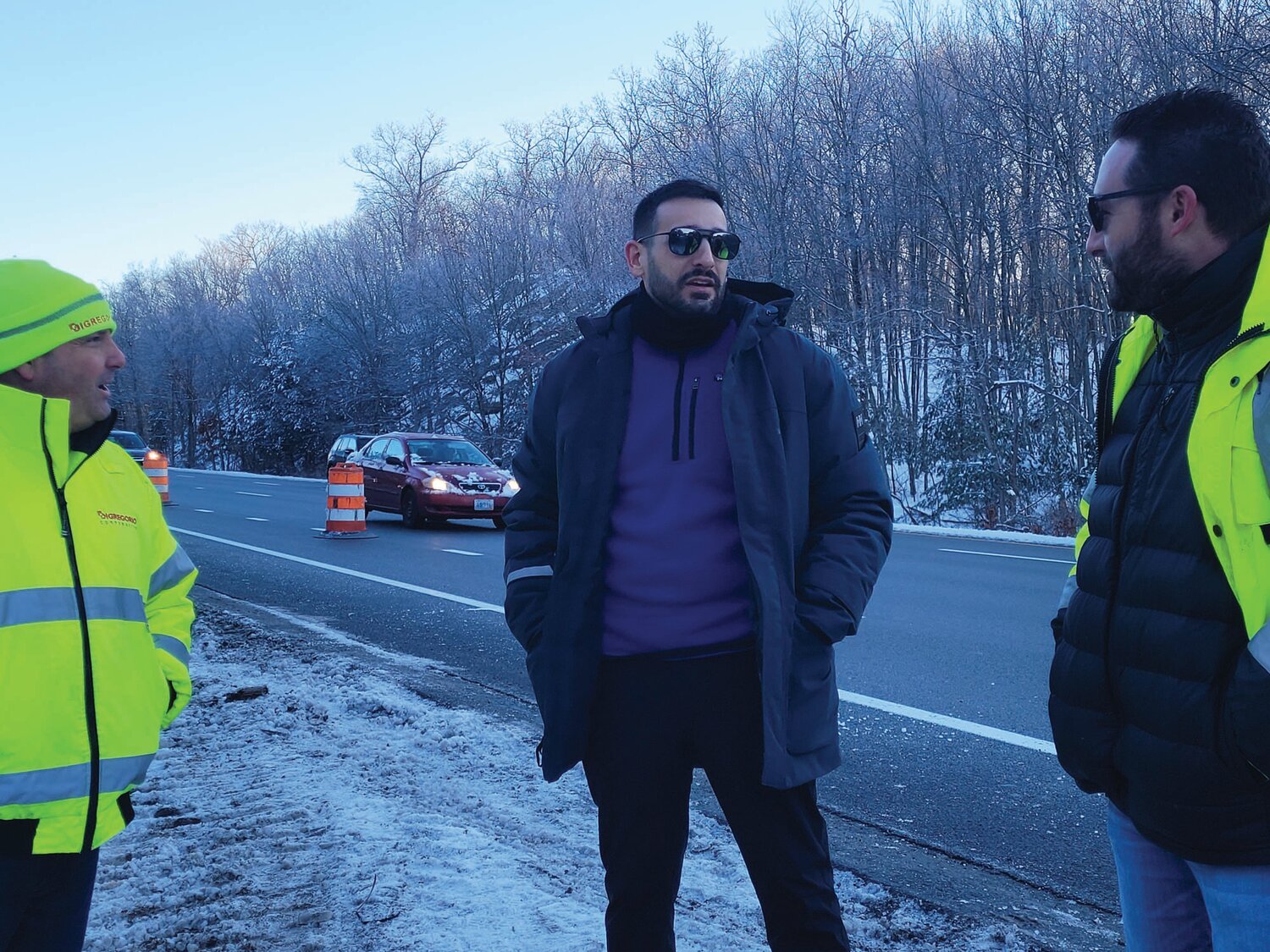
Johnston’s Director of Development and Public Services Thomas Deller addressed the meeting, sketching in some of the details.
“This year we’ve had four major rain storms: July, September, December, and January,” Deller said. “One of the things we’ve learned is that our stormwater system is … under-designed.”
Wetter & Wetter
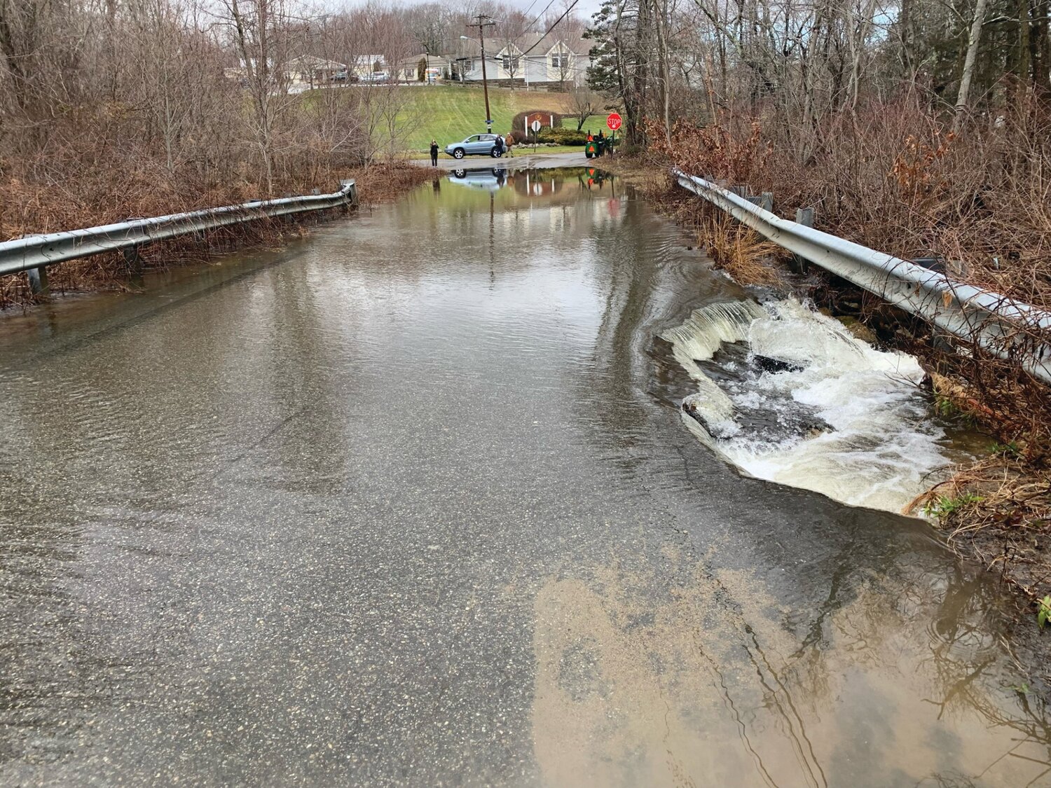
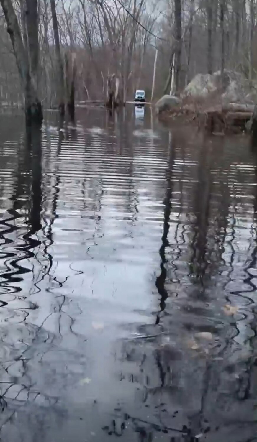
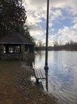
Residents along Belfield Drive were forced to leave their homes; the street evacuated. An emergency access road was constructed, with begged federal permission, off Interstate 295 South.
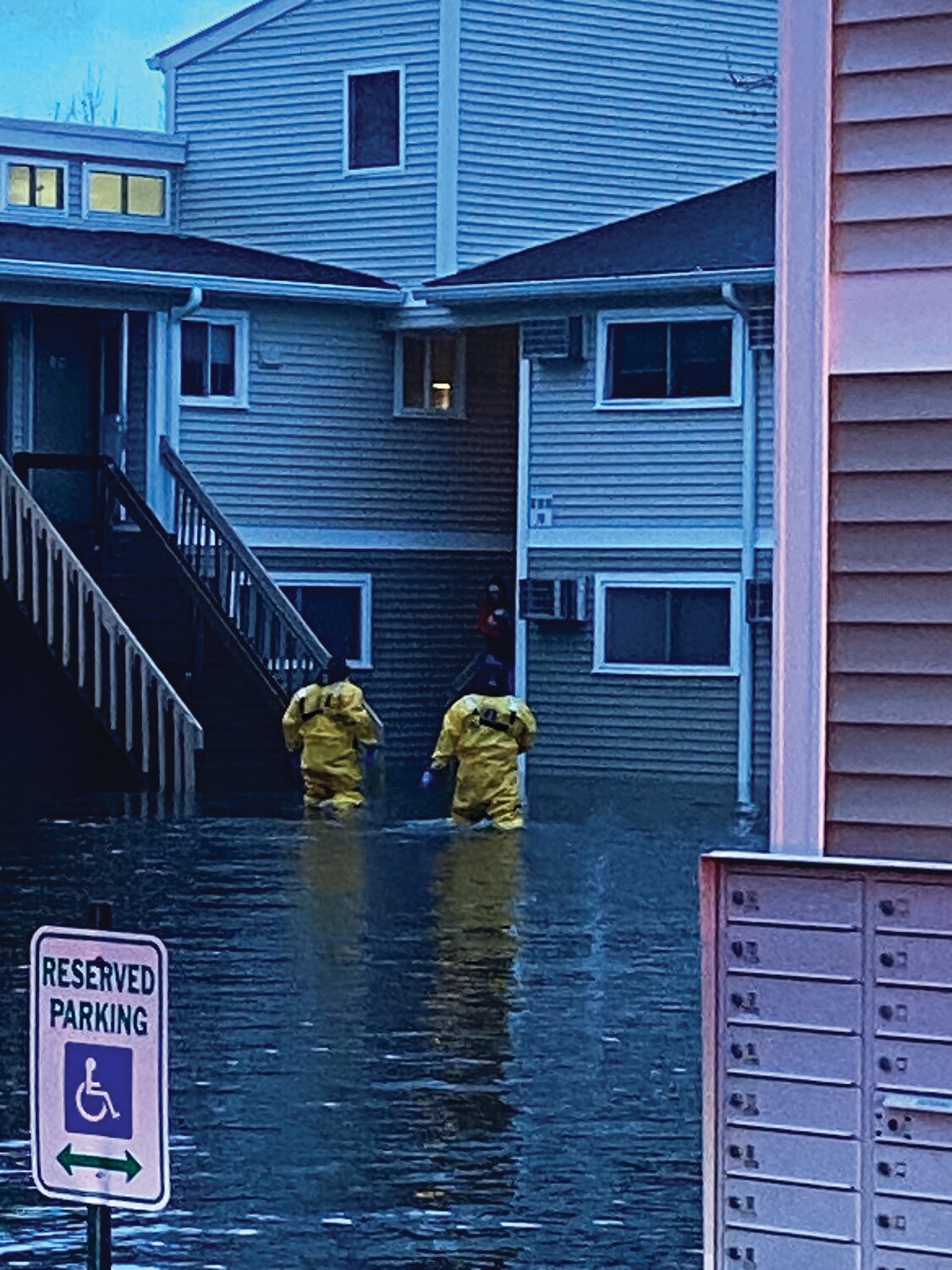
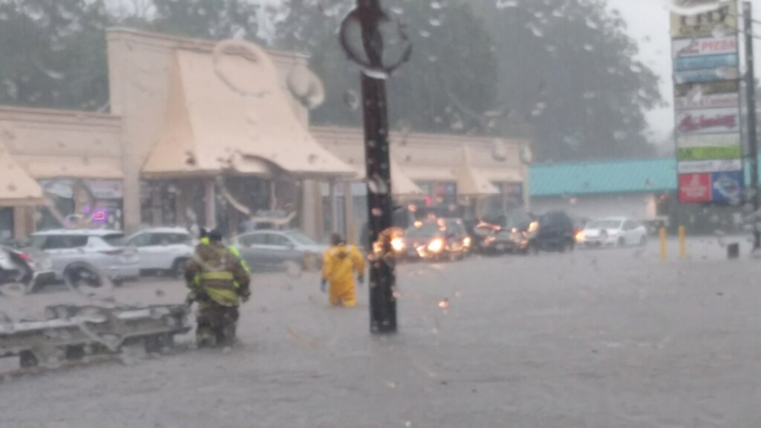
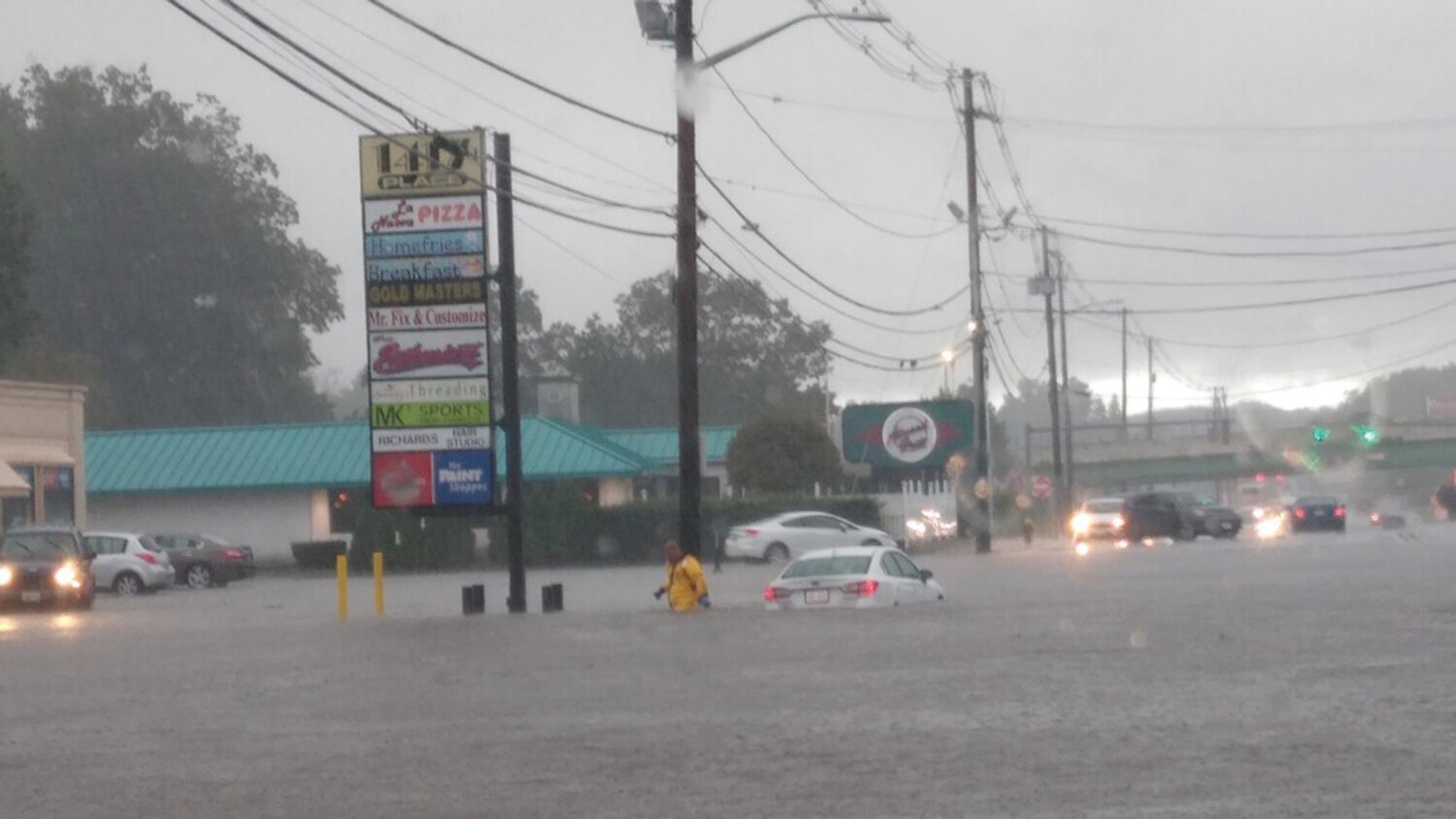
A Park Street apartment complex flooded; residents and pets were rescued by first-responders in boats.
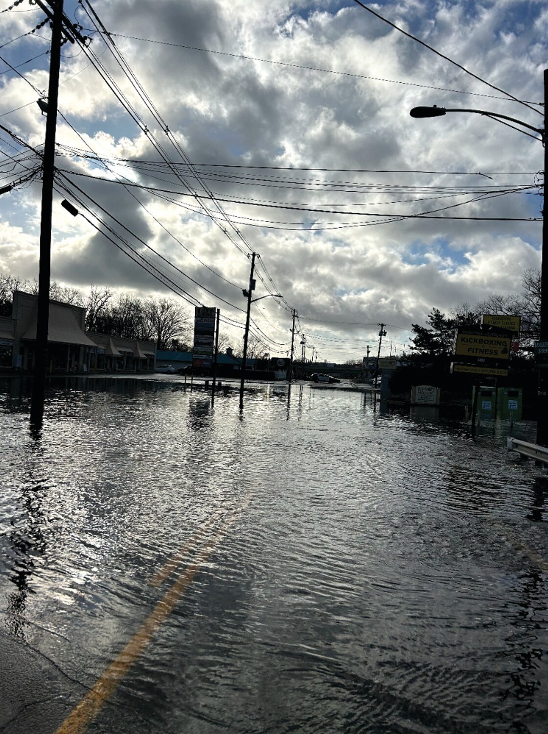
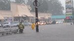
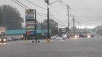
Atwood Avenue (also known as state Route 5) has periodically slipped below the surface of rising flood waters, disrupting businesses and cutting the town’s central district off from commuters and customers.
According to Deller, town planners have “been spending a lot of time over the last few months studying the problem.”
He presented maps showing flood issues throughout town — issues only reported since the January storm — to members of town council.
“This area was less than 21% developed 40 years ago, but … today, it’s close to 55-60% developed,” Deller told town council. “And all that … storm water is going into our systems, overflowing the systems we have today.”
Belfield Drive has been drying out in the shadow of the unopened (and so far unused) Amazon robotic
fulfillment center, constructed last year off Hartford Avenue. Across the street sits an unfinished rehabilitation hospital. The past few years have been booming for development in Johnston.
As Deller explained, development in town has multiplied three-fold over the past four decades. Thick development and soaking unprecedented storms have combined forces, making large swathes of town practically unlivable (and in some cases, unreachable).
What’s the Plan?
Deller and Johnston Mayor Joseph M. Polisena Jr. have been meeting with engineers and examining options that once might have been considered extreme, like widespread home buyouts and demolition projects.
“We’ve come to realize that there’s not enough pipes or catch basins that we can build to solve this problem,” Deller explained. “We need to think about buying land and creating detention areas that will hold the storm water so we can meter it out over time.”
Polisena has been foreshadowing the impending need for a hefty flood bond to remediate the ongoing, worsening water issues in town.
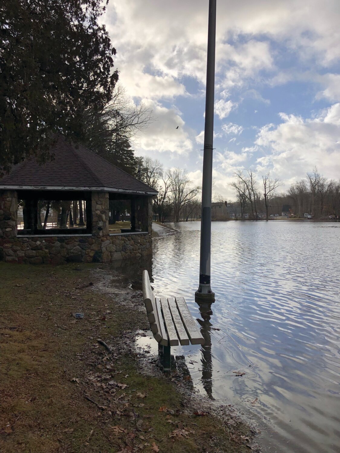
“If passed by the voters, the money from this bond will be used to address severe and non-severe but high volume (large number of people affected) areas that suffer from chronic flooding and drainage issues,” Polisena wrote via email last week. “The only way this bond works for everyone, as some people in the town may not have flooding issues, is if we use this bond to also address Atwood Avenue and Johnston Memorial Park. Addressing those two problem areas allows everyone in the town to benefit, not only specific neighborhoods that will be addressed.”
Deller briefed town council on the bond votes they will be asked to take.
“The way the process works … You have to ask the legislature to pass the resolution,” Deller explained. “We then have to come back to you for a detailed bonding resolution that you have to pass. And then that goes on the ballot for a November vote.”
The Process?
Polisena promises more details will quickly emerge over the next few months.
“Before residents vote on it in November, we will present each project, which will be a mix of piping improvements, home buyouts, detention pond creations and road upgrades, depending on the specific problem area,” Polisena explained. “We will also present how much we are using and how much this costs to the average property tax bill. Then the people can decide in November if it’s worth the cost.”
The number — $40 million — may ultimately, hopefully, be higher than needed.
“Why is the number so big?” Deller asked, standing before town council. “We hope not to spend that much money. But if we’re going to go forward, we wanted enough authorization to carry out the project as it developed. We didn’t want to have to go back … and ask for more.”
The full scope of the projects (to be funded) has yet to be realized, and could even change depending on the forecast.
“We’re still working on what the projects will be, but the legislative deadline to get this submitted to the General Assembly, which has to approve G.O. bonds for municipalities, is Thursday, Feb. 15,” Polisena said. “There won’t be any ribbon cuttings or fanfare with these projects. However, after what happened this past fall and winter and with the increasing amount of storms we are getting as time goes on, we can’t continue to live like this.”
The mayor’s looking to replace a Band-Aid with a tourniquet, but trying to save all of the town’s limbs.
“Right now, we’re responding to the symptoms as best we can deploying military vehicles, building temporary roads, pumping water out of basements, closing roads, paying for hotels, using overtime on police, fire and DPW,” Polisena said. “It’s too expensive to do annually and once the water subsides, the problems are still there for the next time. Ultimately, we need to address the underlying disease. That’s old infrastructure, which plagues much of New England, and the Pocasset River. That river and the brooks that run off it are a major cause of the problems we face.”
Asked recently about over-development, and recent huge development projects, the mayor said he looks to the state’s Department of Environmental Management (DEM) to advise planners when it comes to stormwater management and wetland evasion. Each of the recent and ongoing development projects in town ultimately earned DEM (and town) approval.
And All Its Tributaries
Deller shared discussions he’s been having with Councilwoman Linda Folcarelli, “about the problems with the Pocasset River in her ward”
“The Pocasset Watershed virtually covers the whole town and that it starts on the north side of Brown Avenue, runs through Snake Den Park, down through Belfield Avenue, all the way through town,” Deller explained to town council. “And as that water comes down, it grows in volume and speed and causes … problems. What we need to do is we need to think about how we acquire land, set it aside and create it as an area to hold that storm water and meter it out slowly so we can reduce the flooding.”
The approach to come will be varied and widespread.
“But that’s not the only solution,” Deller said. “We are going to have to buy houses. And we are going to have to demolish those properties and make that … land open for storm water … We are in the very early stages of developing a comprehensive storm water plan for the town.”
Deller has been leading teams, assessing river channels throughout town.
“We’ve actually been cleaning out pipes, cleaning out river beds to make sure the water flows … What Belfield Drive has taught us, is that even though we anticipate some of this stuff, the storms have been worse than we anticipated,” Deller said. “Just on Belfield Drive, for example, the flood plain elevation is 253.4 feet above sea level. Everything has to be designed to that flood level. The new bridge on Belfield is … two feet above flood level. And yet in the January storm it was three feet under water.”


Comments
No comments on this item Please log in to comment by clicking here